Hurricane Helene
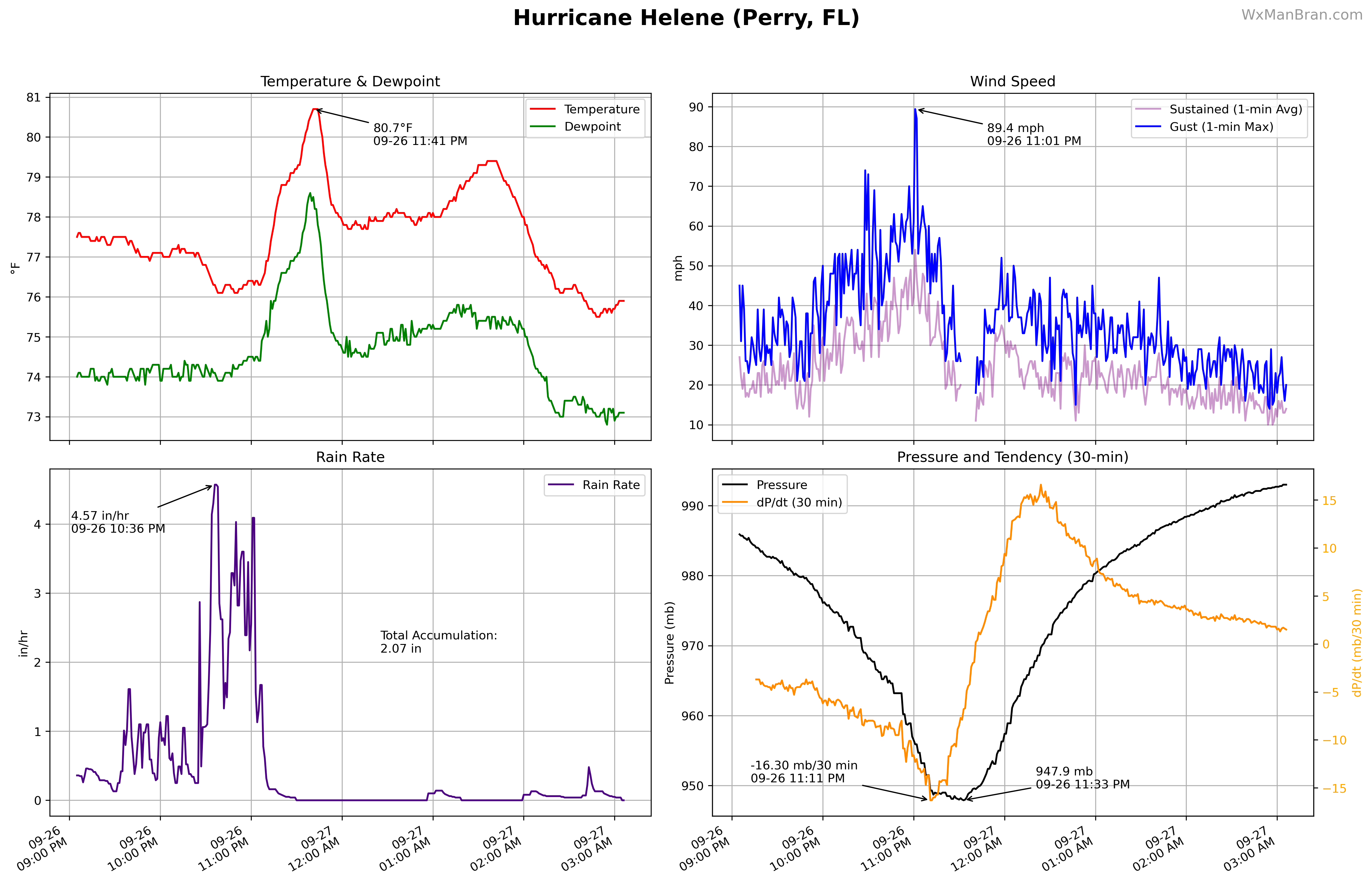
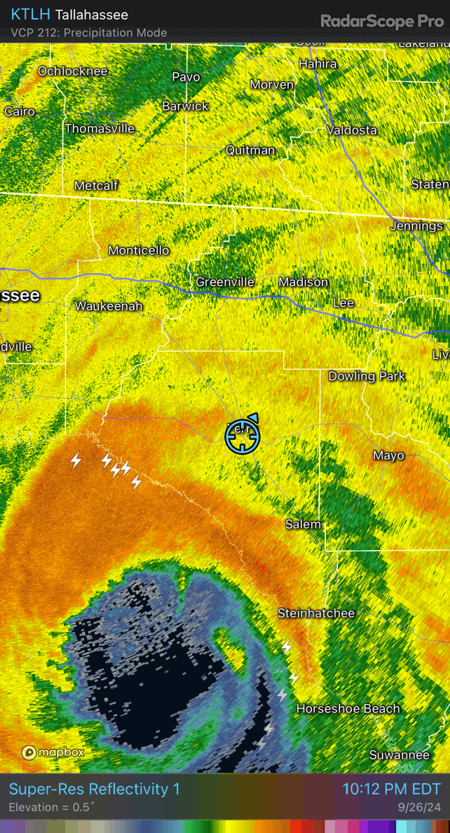
Hurricane Helene formed in the northwestern Caribbean on September 24 and rapidly intensified over very warm Gulf waters with low wind shear, growing in size as it accelerated toward Florida’s Big Bend. Helene made Category 4 landfall near Perry late on September 26, driving life-threatening storm surge of 12 to 16 feet in parts of the Big Bend and producing hurricane-force gusts far inland because of its fast forward speed. The storm then raced through Georgia and the Carolinas, unleashing catastrophic freshwater flooding and landslides across the southern Appalachians, spawning dozens of tornadoes, and causing widespread power outages and infrastructure damage from the Gulf Coast to the Mid-Atlantic.
Overview
- Storm Intensity: Category 4 at landfall
- Max Winds: 140 mph (120 kt)
- Formation: September 24, 2024 over the northwestern Caribbean Sea
- Landfall: 11:10 PM EDT September 26 near Perry, Florida
- Minimum Pressure: 939 mb at landfall
Timeline
- September 24: Tropical storm forms in the northwestern Caribbean and moves toward the Gulf.
- September 26: Rapid intensification over the Gulf; becomes a major hurricane by evening.
- Late September 26: Landfall in Florida’s Big Bend as a Category 4 hurricane; life-threatening storm surge.
- September 27–28: Races inland and weakens; dissipates over Tennessee on September 28.
Impacts
- Storm surge: 12–16 ft inundation in parts of Florida’s Big Bend, with severe damage around Keaton Beach.
- Wind: Very fast forward speed spread hurricane-force gusts far inland; extensive tree damage and power outages across GA, SC, and NC.
- Rain and flooding: Catastrophic flooding and landslides across western North Carolina and nearby areas.
- Tornadoes: At least 33 tornadoes while Helene was a tropical cyclone (39 including post-tropical).
- Fatalities: At least 249 deaths in the U.S. (175 direct, 71 indirect, 3 unknown causes).
Source
The information above is sourced from the National Hurricane Center’s Tropical Cyclone Report. You can view the full document here.
Media
Photos

Videos
Videos coming soon.
Data
Multi-Panel Plots