Hurricane Hermine
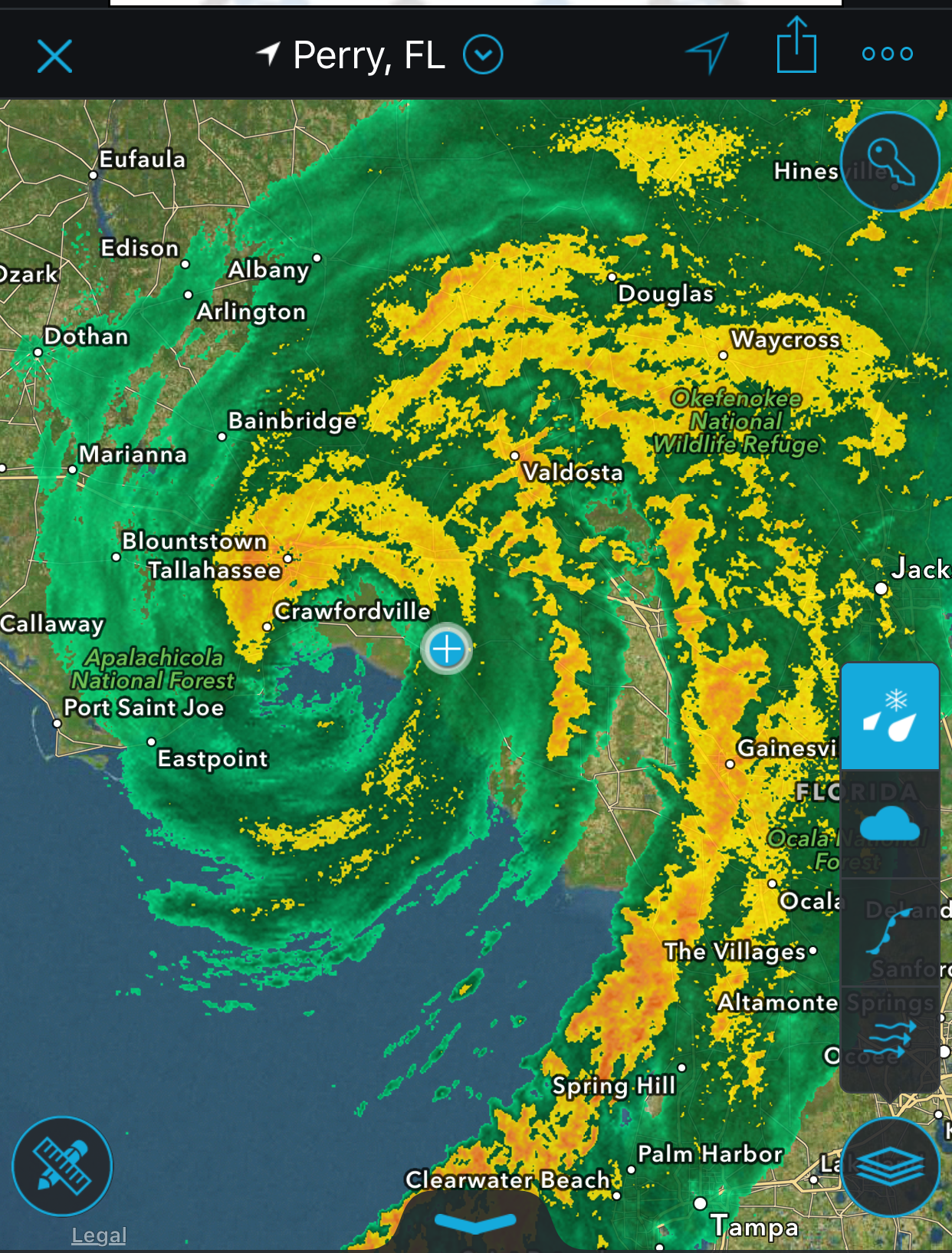
Hermine was a compact, fast-strengthening Gulf cyclone that became a Category 1 hurricane before striking Florida’s Big Bend coast just east of St. Marks. The system formed from a tropical wave, organized over the Straits of Florida, and steadily intensified over very warm waters and improving upper-level conditions. Hermine reached peak intensity of 70 kt (80 mph) late on September 1 into early September 2 and brought destructive storm surge along the Nature Coast, flooding rains across Florida’s west coast into the Southeast, and a small outbreak of tornadoes. After landfall, Hermine weakened while sweeping northeast across Georgia and the Carolinas, with widespread power outages and pockets of wind and water damage.
Overview
- Storm Intensity: Category 1 hurricane at landfall
- Max Winds: 80 mph (70 kt)
- Formation: August 28, 2016 at 1800 UTC (2:00 PM EDT) over the Straits of Florida about 50 n mi south-southeast of Key West
- Landfall: Near St. Marks, Florida on September 2, 2016 at 0530 UTC (1:30 AM EDT)
- Minimum Pressure: 981 mb (at landfall)
Timeline
- August 28, 2016: Tropical depression forms in the Straits of Florida.
- August 31, 2016: Strengthens into a tropical storm while turning north.
- September 1, 2016 at 1800 UTC (2:00 PM EDT): Becomes a hurricane over the northeastern Gulf of Mexico.
- September 2, 2016 at 0530 UTC (1:30 AM EDT): Makes landfall just east of St. Marks, then weakens inland through the day.
Impacts
- Storm surge and inundation: Peak measured surge of 7.50 ft at Cedar Key; 4–7 ft inundation east of landfall across Jefferson, Taylor, Dixie, and Levy Counties. Tampa Bay and the west-central coast saw 2–4 ft inundation with several gauges recording 3–4 ft storm tides.
- Rainfall and flooding: Maximum storm-total rainfall of 22.36 inches near Tarpon Springs (Pinellas County), with numerous 10+ inch totals along Florida’s west coast and heavy rain extending into Georgia, South Carolina, and North Carolina with local flooding.
- Tornadoes: Ten total—five in Florida, two in Georgia, and three in North Carolina.
- Power outages: Over 253,000 customers without power in Florida; about 65% of Tallahassee customers impacted and 91% in Wakulla County.
- Fatalities: One direct death in Ocala, Florida; an additional fatality occurred in North Carolina during strong winds the next morning.
- Damage: Estimated $550 million (wind and water).
Source
The information above is sourced from the National Hurricane Center’s Tropical Cyclone Report. You can view the full document here.
Media
Photos
Videos
Videos coming soon.
Data
No data was gathered during this storm intercept.